The Gulf dead zone gets reported as an area on a map. Read it as a missing nursery and the fix comes into focus.
I came to this work through fish.
Before I had words for nutrient loading or hypoxia, I was a kid who caught fish, kept fish, and sat in front of a tank for hours watching them. That interest grew up with me. Permaculture training gave it a frame, and a permaculture designer looks at a river mouth the way a machinist looks at a good lathe: equipment built to make something, and built well.
So when the Gulf dead zone comes up, I read it as a production problem.
The numbers we use
The standard description runs flat. Low dissolved oxygen. Hypoxia. An area in square miles, set beside the outline of a state for scale.
In June, NOAA forecast 7,027 square miles for 2026, within reach of the 8,776-square-mile record set in 2017. The survey cruise in late July measured about 1,332, days after Tropical Storm Bertha churned the northern Gulf and mixed oxygen down to the seabed. Did the Dead Zone Shrink? walks through why that small number tells us more about the wind than the river.
Either figure describes a shape on a chart. A state outline gives you the size of the hole. It leaves out what used to fill it.
What should be living there
A working rule among people who design with water holds that roughly ninety percent of the fish occupy about ten percent of the water, and that ten percent sits along the edge: the shallows, the shoreline, the seam where one set of conditions presses against another. Conditions shift fast at an edge, and that shifting makes room for many kinds of life in a small space, on land and in water alike.
A great river mouth stacks edge on edge. Run a line from a hundred miles up the Mississippi to a hundred miles out into the Gulf and you cross a long run of distinct living worlds. Salt water leans into fresh, and the boundary moves with each tide. Pools fill and drain. Deep bays run beside flats that go to mud at low water. Swamp gives way to channel. Cold river water meets warm Gulf current, and the eddies fold them together. Stand at the edge and you can smell it working, that rich, low stink a healthy system gives off, like a busy kitchen an hour before service.
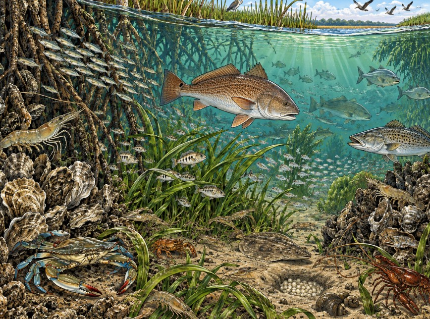
Estuaries hold some of the densest concentrations of life per acre on Earth, and they serve as nurseries for much of what lands on a Gulf Coast plate. Brown shrimp, white shrimp, oysters, redfish, crabs: they grow up in that marsh-and-mud edge before anyone hauls them aboard. The Foundation covered the fishery stakes in Selfish reasons the Dead Zone matters.
That is the place we are smothering.
How the nursery gets smothered
Nitrogen and phosphorus drain into the Mississippi from about forty percent of the lower forty-eight states: farm fertilizer, city runoff, half a continent’s drainage headed for one mouth.
At the Gulf, fresh river water spreads over denser salt water and rides on top of it, and that boundary works like a lid on a pot. The nutrients feed an algae bloom. The algae die, sink, and rot, and the rot draws oxygen out of the bottom water while the lid keeps fresh oxygen from reaching down. What can swim away leaves. What can’t, suffocates. For a season, one of the continent’s great nurseries becomes water where very little can breathe.
Explaining Dead Zones lays out the process, and Lessons from the Aquarium – The Nitrogen Cycle shows the same chemistry at home-tank scale.
A discharge rate can be turned down
Every piece of this can be prevented. The dead zone is a discharge rate, and discharge rates can be adjusted. Lower the nutrient load the river carries, the bottom water holds its oxygen, and the nursery reopens.
Fish reward that fast. Give them one cleaner breeding season, with water fit to spawn, mix, and feed in, and they answer in the next cycle. Give them several and the gains compound: more shrimp in the trawls, more oysters on the reefs, more fish at the docks and on the table.
Federal and state strategy works the front end, cutting what enters the river. Nitrogen has moved in the right direction. Phosphorus has crept upward. The River Refugium Project works the other end. Intercept nutrient-loaded water inside the basin, grow the nitrogen and phosphorus into plants, algae, and fish, harvest that biomass, and move it out of the watershed as product. Reduction lowers what goes in. Harvest pulls out what has already arrived. A basin that has been banking nutrient since the 1950s needs both.
Inside that loop, the biology gets built like a forest. The refugium stage creates habitat for a layered bacterial community, each group working its own niche, with room left for organisms nobody has named yet. The Refugium Is Not a Filter lays out that design logic. Bioaccumulators – an RRP Appendix covers the plant roster, chosen against the pollutants in a given stretch of water.
One river, then the rest
The Gulf is the nearest case. Rivers around the world carry their own loads to their own seas, and their mouths are nurseries under the same pressure. Bring one watershed back into balance, let other nations do the same with theirs, and the fisheries recover together, breeding cycle by breeding cycle, because the sea is one connected body fed from its edges. River Refugium Project – Global Edition carries the idea past the Mississippi.
The underlying methods are established. What the project needs is an operator with industrial-scale capacity and a crew that understands the mission.
I started as a boy who loved fish, and I’ll finish as the grown version of him. Strip away the clinical words and the dead zone comes down to a missing feast. We know what belongs in that water. We know why it left. We know how to invite it back. Off the Louisiana coast a table sits set for one of the great gatherings of life on the continent, and each summer the chairs stay empty.
We can change that. We should.
Where to go next
Start here
- Introducing the River Refugium Project
- River Refugium Project – simplified
- Where did the idea come from?
The design
- River Refugium Flow Chart
- Learning from Swamps
- The Sea That Got Too Clean
- Expanding the Margins of Pond Production: the same loop at farm-pond scale
The economics
The documents (open access, reproduction and adaptation permitted)
- River Refugium Project, Version 3.0 — Released
- RRP0003 — Consolidated Technical Whitepaper, Version 3.0
- Appendix B — National Watershed Priority Map
- Appendix C — Initial Recommended Sites
- Full project library: https://www.cernunnosfoundation.com/rrp/
Sources
- NOAA, 2026 Gulf hypoxia forecast, June 2026
- NOAA / NCCOS, “NOAA, Partners Measure Smaller-than-Anticipated Hypoxic Zone in Gulf,” August 5, 2026
- LUMCON, 2026 Shelfwide Hypoxia Cruise data
- NOAA, 2017 record hypoxic zone measurement (8,776 sq mi)